House, Building & Neighborhood Histories in Tulsa
Preliminary Information
Start your research by finding the property's legal description and the building's construction date. Look at the property tax statement or the Tulsa County Assessor's website for a property's legal description and a building's date of construction. The legal description is found in the quick facts and general information sections. A legal description shows the exact location of a property and includes township, range, and section. The date of construction is found in the improvements section. Note that the date of construction on the Assessor's website is a good place to start but is not always accurate.
Books on the Research Process
Discovering The History Of Your House And Your Neighborhood / Betsy J. Green
House Histories: A Guide To Tracing The Genealogy Of Your Home / Sally Light
Neighborhoods
Tulsa County Clerk
 The Tulsa County Clerk is the recorder and custodian of land records and other real estate documents in the county.
Land records are freely accessible in the Tulsa County Clerk's office. In the office, there are public access computers. On the public access computer desktops, there are links to the County Clerk Track Index folder, the Tulsa, OK Recorder database, and the Digital Reel database. The County Clerk Track Index folder is organized by subdivision. Here, you will find information on when a subdivision was platted and book and page and document numbers that you can use to find records in the other two databases. In the Tulsa, OK Recorder database, you can find content dating back to 1928. You can use the property's legal description to find post 1987 records. You can use book and page numbers to find pre 1987 records. Use the Digital Reel database for pre 1928 records.
You can print from the public access computers for $1 per page.
The Tulsa County Clerk has placed the Historical Unplatted Tract Index, the Historical Platted Tract Index, Tulsa County Plats, and the Historical Grantor/Grantor Deed Index online.
Tulsa County Clerk | Tulsa County Administration Building, Room 120 | 500 S. Denver | Tulsa, OK 74103-3832 | County Clerk Switchboard: (918) 596-5801 | Fax: (918) 596-5819 | Office hours: 8:30 a.m.-5 p.m., Monday-Friday (excluding holidays)
Vertical Files
One of the unique resources in the Research Center's Oklahoma Room is the extensive vertical file collection. Vertical files contain newspaper and magazine articles, brochures, reports, and ephemera for businesses, organizations, homes, buildings, events, and people in the area.
Newspaper articles, covering topics of local and regional interest, were selectively chosen from Tulsa’s major metropolitan dailies of the twentieth century and deposited in subject-based vertical files. This is the only major index in Tulsa for the Tulsa Tribune and for the Tulsa World before 1989. For more information on newspaper and periodical articles, please see our guide.
Vertical file titles can be searched in the online catalog. To limit your search to the vertical files in the new catalog, use advanced search. In the "use the form below to construct your query" section, use your keyword and the terms "vertical file." To limit your search to the vertical files in the old (legacy) catalog, use the advanced search. Enter your keyword in the "anywhere" field, and choose "vertical file" from the "material type" drop-down box.
Vertical file titles that might help with your neighborhood research include:
Neighborhoods
Parks
Schools
Churches
Local Publications Index
The Local Publications Index provides a searchable online index to older Tulsa area publications housed at the Central Library. These publications include: The American Indian, Gusher, Magazine Tulsa, Tulsa Home & Garden, and Tulsa School Review. The documents in the index are not available online. You may access them by visiting the Research Center at Central Library, emailing us at askus@tulsalibrary.org, or calling 918-549-7323.
Depending on the neighborhood, you may find articles in the local publications index.
Bookshelf
Tulsa Historic Preservation Resource Document (1997)
Tulsa Historic Preservation Plan Report (1980)
Maps & Atlases
Atlas of Tulsa, Oklahoma (1987)
Available in the Oklahoma Room on the 3rd floor of Central Library
Atlas of Tulsa, Oklahoma (1970)
Available in the Oklahoma Room on the 3rd floor of Central Library
Atlas of Tulsa, Oklahoma (1937)
Available in the Oklahoma Room on the 3rd floor of Central Library
Cherokee Nation Township Plat Maps
236 Cherokee Nation township plat maps that include townships 9 north through 29 north have been digitized by the Oklahoma Historical Society. An interesting characteristic of these maps is the meticulous detail with which the ownership of allotments is shown. Each map contains the names, statuses, and allotment numbers of the individual owners. The maps were probably printed after statehood in 1907, by the Indian Territory Map Company in Muskogee, but the information comes from the Dawes Commission which began its work in 1893. Search the archives catalog using the phrase "MAP OF CHEROKEE NATION TOWNSHIP."
Hastain's Township Plats of the Creek Nation (1910)
Hastain's Township Plats of the Creek Nation was published by E. Hastain in Muskogee, Oklahoma in 1910. This publication shows the location of allotments given to members of the Creek Nation. It lists the names of allottees, their roll number, and if the allotment was the location of the homestead. Many individuals received allotments in more than one location. The Oklahoma Historical Society has an online database for searching the Creek Nation plats by name and roll number.
Digital images include historical Oklahoma and Tulsa maps representing a fraction of the map collection available in the Research Center on the 3rd floor of Central Library. For more information on the physical map collection, see print map collection link below.
Tulsa Enumeration District Maps 1910,1920,1930,1940 are available online.
When the Bureau of the Census assigned areas for census takers to visit, it divided counties, cities, towns, villages, Indian reservations, and even hospitals and jails into enumeration districts (ED). Each county was assigned a number, and each ED within it was then numbered consecutively. When the census schedule sheets were compiled, they were arranged by state, county, city or township, and thereunder by ED number. You can gather information about areas outside the city with these maps.
Tulsa aerial photographs from the 1950s and 1960s are available online. They are described by township, range and section.
This guide provides a broader view of the large map collection in the Research Center on the 3rd floor of Central Library and includes other historical Tulsa maps. Some of the maps have been digitized. See digitized map collection above.
Neighborhood Histories
From the Urban Development Department and Tulsa Preservation Commission, these booklets provide a brief history of the neighborhood and information on individual homes.
A Neighborhood History of Tulsa's Historic Brady Heights (1998)
A Neighborhood History Of Tulsa's Historic Dawson (1999)
A Neighborhood History Of Tulsa's Historic Gillette (1996)
A Neighborhood History Of Tulsa's Historic Kendall-Whittier (1999)
A Neighborhood History Of Tulsa's Historic Maple Ridge (1996)
A Neighborhood History Of Tulsa's Historic Owen Park (1998)
A Neighborhood History Of Tulsa's Historic Reservoir Hill (1999)
A Neighborhood History Of Tulsa's Historic Riverview (1996)
Early History Of Southwest Tulsa (1996)
A Neighborhood History Of Tulsa's Historic Swan Lake (1994)
A Neighborhood History Of Tulsa's Historic Tracy Park (1999)
A Neighborhood History Of Tulsa's Historic White City (1998)
Architectural Surveys
Architectural/Historic Survey of Certain Parts of Tulsa Part One (1991)
Architectural/Historic Survey of Certain Parts of Tulsa Part Two (1991)
Downtown Tulsa Intensive-Level Historic Resources Survey (2009)
Historic Resources Survey of The Cliff Dweller Houses on Reservoir Hill (2012)
Intensive Level Survey of Owen Park Neighborhood (1995)
Intensive Level Survey of Red Fork Area (2002)
Intensive Level Survey of Riverside Neighborhood (2003)
Intensive Level Survey of Swan Lake Neighborhood (1994/1996)
Intensive Level Survey of White City Neighborhood (2000)
Intensive Level Survey of Yorktown Neighborhood (2001)
Documents: National Register Tulsa County Neighborhood/District
AVAILABLE ONLINE FROM THE STATE HISTORIC PRESERVATION OFFICE
6th Street Commercial/Residential Historic District (2009)
Blue Dome Historic District (2011)
Brady Historic District (2010)
Brady Heights Historic District (1988)
Buena Vista Historic District (2006)
Carlton Place Historic District (2006)
Gillette Historic District (1982)
Katy Railroad Historic District (2011)
Maple Ridge Historic Residential District (1979)
North Cheyenne Avenue Historic District (2010)
Oil Capital Historic District (2010)
Owen Park Historic District (1995)
Ranch Acres Historic District (2007
Riverside Historic Residential District (2004)
Riverview Historic District (2006)
Stonebraker Heights Historic District (2006)
Swan Lake Historic District (1996)
Tracy Park Historic District (1982)
Tulsa Civic Center Historic Center (2011)
White City Historic District (2001)
Whittier Square Historic District (2012)
Woodward Park and Gardens Historic District (2013)
Yorktown Historic District (2002)
Other Resources
National Register of Historic Places
Land
Abstracts
List of Tulsa Abstract and Title Companies
An abstract is a compilation of all instruments of record in the County Clerk's and Court Clerk's offices which materially affect a specific tract of land. Basically, it is all the legal records about a tract of land. Note that the abstract is specific to the land and not the building.
The abstract of a property may be in the possession of the home owner or an abstract and title company. Abstract and title companies will allow you to examine an abstract in their office. A list of Tulsa abstract and title companies is located below. You will need the property's legal description when you call the companies to find the location of your property's abstract. Please see the getting started tab for more information on a property's legal description.
Tulsa View
Tulsa View is a mapping software product provided by the Tulsa County Assessor's Office. It graphically displays land plots based on the annual tax assessor's rolls. This program is available at the Central Library Research Center on PCs RS017C and RS029C.
You can use Tulsa View to find:
- Property dimensions
- Property owners
- Zoning codes
- Subdivision boundaries
- Unplatted land
- Physical descriptions and characteristics
Maps & Atlases
Atlas of Tulsa, Oklahoma (1987)
Atlas of Tulsa, Oklahoma (1970)
Atlas of Tulsa, Oklahoma (1937)
Cherokee Nation Township Plat Maps
236 Cherokee Nation township plat maps that include townships 9 north through 29 north have been digitized by the Oklahoma Historical Society. An interesting characteristic of these maps is the meticulous detail with which the ownership of allotments is shown. Each map contains the names, statuses, and allotment numbers of the individual owners. The maps were probably printed after statehood in 1907, by the Indian Territory Map Company in Muskogee, but the information comes from the Dawes Commission which began its work in 1893. Search the archives catalog using the phrase "MAP OF CHEROKEE NATION TOWNSHIP."
Hastain's Township Plats of the Creek Nation (1910)
Hastain's Township Plats of the Creek Nation was published by E. Hastain in Muskogee, Oklahoma in 1910. This publication shows the location of allotments given to members of the Creek Nation. It lists the names of allottees, their roll number, and if the allotment was the location of the homestead. Many individuals received allotments in more than one location.
A fraction of the print map collection available in the Research Center on the 3rd floor of Central Library is available online. For more information on the physical map collection, see print map collection link below.
Tulsa Enumeration District Maps 1910,1920,1930,1940 are available online.
When the Bureau of the Census assigned areas for census takers to visit, it divided counties, cities, towns, villages, Indian reservations, and even hospitals and jails into enumeration districts (ED). Each county was assigned a number, and each ED within it was then numbered consecutively. When the census schedule sheets were compiled, they were arranged by state, county, city or township, and thereunder by ED number. You can gather information about land areas within the city and outside the city with these maps.
Tulsa aerial photographs from the 50s and 60s are available online. They are described by township, range, and section.
This guide provides a broader view of the large map collection in the Research Center on the 3rd floor of Central Library and includes other historical Tulsa maps. Some of the maps have been digitized. See digitized map collection above.
Tulsa County Clerk
 The Tulsa County Clerk is the recorder and custodian of land records and other real estate documents in the county.
Land records are freely accessible in the Tulsa County Clerk's office. In the office, there are public access computers. On the public access computer desktops, there are links to the County Clerk Track Index folder, the Tulsa, OK Recorder database, and the Digital Reel database. The County Clerk Track Index folder is organized by subdivision. Here, you will find information on when a subdivision was platted and book and page and document numbers that you can use to find records in the other two databases. In the Tulsa, OK Recorder database, you can find content dating back to 1928. You can use the property's legal description to find post 1987 records. You can use book and page numbers to find pre 1987 records. Use the Digital Reel database for pre 1928 records.
You can print from the public access computers for $1.00 per page.
The Tulsa County Clerk has placed the Historical Unplatted Tract Index, the Historical Platted Tract Index, and Tulsa County Plats online.
Tulsa County Clerk | Tulsa County Administration Building, Room 120 | 500 S. Denver | Tulsa, OK 74103-3832 | County Clerk Switchboard: (918) 596-5801 | Fax: (918) 596-5819 | Office hours: 8:30--5:00 Monday--Friday (excluding holidays)
Tulsa County Assessor
The Tulsa County Assessor is responsible for placing a fair market value on property. Oklahoma property taxes are "ad valorem," a Latin term meaning "as to value."
You will find property information on the Assessor's website. There are a number of ways to search for your property including: owner name, property address, subdivision, account number, parcel number, and map.
Tulsa County Assessor | Tulsa County Administration Building, Room 215 | 500 S. Denver | Tulsa, OK 74103 Phone: (918) 596-5100 | Fax: (918) 596-4799 | Email: assessor@tulsacounty.org Office hours: 8:00–5:00 Monday–Friday (excluding holidays)
Buildings
Documents: National Register of Historic Places in Tulsa County
AVAILABLE ONLINE FROM THE STATE HISTORIC PRESERVATION OFFICE
66 Motel
Ambassador Hotel
Atlas Life Building
B.W. McLean House & Office
Belmont Apartments
Boston Avenue Methodist Church
Boulder-on-the-Park
Brady Heights Historic District
Broken Arrow Elementary/Junior High School
Buena Vista Historic District
Cain's Dancing Academy / Cain's Ballroom
Carl K. Dresser House
Carlton Place Historic District
Casa Loma Hotel
Cheairs Furniture Company Building (new in 2018; not available online yet)
Church Studio
Circle Theatre
Cities Service Station #8
City Veterinary Hospital
Clinton-Hardy House
Cosden Building
Creek Council Tree Site
Dawson School
Eleventh Street Arkansas River Bridge
Elizabeth Manor
First National Bank
Foster B. Parriot House
Fort Arbuckle Site
Fox Hotel
Gillette Historic District
Gillette-Tyrell Building
Harwelden
Haskell State School of Agriculture
Holy Family Cathedral Rectory & School
Hooper Brothers Coffee Company Building
James Alexander Veasey House
James H. McBirney House
Katy Railroad Historic District
Maple Ridge Historic Residential District
Mayo Building
Mayo Hotel
Mayo Motor Inn
McFarlin Building
McGregor House
Mincks-Adams Hotel
Moore Manor
Morrow Home Place
Mount Zion Baptist Church
North Cheyenne Avenue Historic District
Oil Capital Historic District
Oklahoma Iron Works/Bethlehem Supply Company Building
Oklahoma Natural Gas Company Building
Owen Park Historic District
Page Memorial Library
Petroleum Building
Philcade Building
Phillips 66 Station #473
Philtower
Pierce Block
Public Service of Oklahoma Building
Ranch Acres Historic District
Riverside Historic Residential District
Riverside Studio (Bruce Goff Designed)
Riverview Historic District
Robert Lawton Jones House
Robert M. McFarlin House
Sally Ann Apartments
Sand Springs Power Plant
Sinclair Service Station
Sophian Plaza
Southwestern Bell Main Dial Building
St. John Vianney Training School for Girls
Stonebraker Heights Historic District
Swan Lake Historic District
Tracey Park Historic District
Tribune Building
Tulsa Civic Center Historic Center
Tulsa Convention Hall (Tulsa Municipal Theater)
Tulsa Fire Alarm Building
Tulsa Monument Company
Tulsa Municipal Building
United States Post Office & Courthouse
Vernon A.M.E. Church
Vickery Phillips 66 Station
Waite Phillips Mansion (Philbrook Art Center)
Westhope
White City Historic District
Whittier Square Historic District
Will Rogers High School
William G. Skelly House
Woodward Park and Gardens Historic District
Yorktown Historic District
Maps
These maps were created to assist fire insurance companies as they assessed the risk associated with insuring a particular property.
Digital images include historical Oklahoma and Tulsa maps representing a fraction of the map collection available in the Research Center of Central Library. For more information on the physical map collection, see print map collection link below.
Tulsa aerial photographs from the 50s and 60s are included in this digital collection. They are described by township, range, and section. See the getting started tab for help finding your property's legal description including township, range, and section.
Bookshelf
One Hundred Historic Tulsa Homes (2000) by John Brooks Walton
One Hundred More Historic Tulsa Homes (2001) by John Brooks Walton
Many More Historic Tulsa Homes (2003) by John Brooks Walton
Tomorrow's Historic Tulsa Homes (2010) by John Brooks Walton
Tulsa Art Deco (2001) Tulsa Foundation For Architecture
Tulsa County Historic Sites (1982)
Tulsa Historic Preservation Resource Document (1997)
Tulsa Oklahoma Properties Listed On The National Register Of Historic Places (1983)
Vertical Files
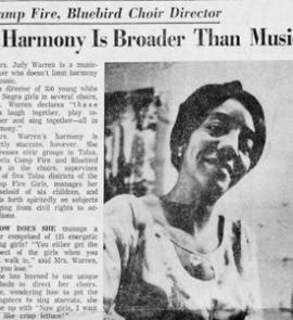
One of the unique resources in the Research Center's OK Room is the extensive vertical file collection. Vertical files contain newspaper and magazine articles, brochures, reports, and ephemera for businesses, organizations, homes, buildings, events, and people in the area.
Newspaper articles, covering topics of local and regional interest, were selectively chosen from Tulsa’s major metropolitan dailies of the twentieth century and deposited in subject-based vertical files. This is the only major index in Tulsa for the Tulsa Tribune and for the Tulsa World before 1989. For more information on newspaper and periodical articles, please see our Tulsa and Oklahoma History Resources In The Research Center guide.
Vertical file titles can be searched in the online catalog. To limit your search to the vertical files in the new catalog, use advanced search. In the "use the form below to construct your query" section, use your keyword and the terms "vertical file." To limit your search to the vertical files in the old (legacy) catalog, use the advanced search. Enter your keyword in the "anywhere" field, and choose "vertical file" from the "material type" drop-down box.
Vertical file titles that might help with your building research include:
Architecture – Homes
Homes - architect awards
Architects
Buildings
Neighborhoods
Local Publications Index
The Local Publications Index provides a searchable online index to older Tulsa area publications housed at the Central Library. These publications include: The American Indian, Gusher, Magazine Tulsa, Tulsa Home & Garden, and Tulsa School Review. The documents in the index are not available online. You may access them by visiting the Research Center at Central Library, emailing us at askus@tulsalibrary.org, or calling 918-549-7323.
Depending on the building, you may find articles in the local publications.
Photographs
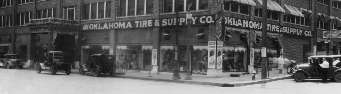
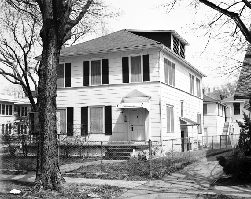
Photographs of the building may be found in the Digital Collections. Search by building name, address, street name(s), intersections, neighborhood, and/or city.
Unidentified Homes on Flickr
 The Tulsa City-County Library would like your help indentifying the unknown people and places in our digital collections. Visit the library's special collections on Flickr and look for the unknown sets.
Other Resources
Tulsa Foundation for Architecture
People
Print Directories
The following directories are housed in the Research Center of Central Library:
City Directories 1909-present (with these exceptions: 1945, 1949, 1952, 1962, and 1998)
City directories are a great resource for finding people. Entries often include occupation and adult children living in a household. Beginning in 1912, the directories may be searched in a reverse manner as the streets are listed alphabetically. This collection is available in both print and microfilm formats.
Telephone Directories 1931-present
The telephone directories include both residential and business listings and cover a greater geographic area than the city directories.
Cross Reference Directories 1944-present
Cross reference directories in the collection are organized by telephone number and by street address.
City Directories Online
The 1909-1935 Tulsa City Directories are available in the Ancestry Library Edition database. If you don't have your own subscription to Ancestry.com, Ancestry Library Edition is accessible at any library location.
City Directory Digital Collection
The 1910, 1920, 1921, and 1922 Tulsa City Directories have been digitized and are accessible from outside of the library.
Ancestry Library Edition
Search census, military, land, immigration, vital records, and family trees. Available at any library location.
Death Notices, Obituaries, and Other Articles
Use this guide to find death notices, obituaries and other articles in Tulsa newspapers.
Local Publications Index
The Local Publications Index provides a searchable online index to older Tulsa area publications housed at the Central Library. These publications include: The American Indian, Gusher, Magazine Tulsa, Tulsa Home & Garden, and Tulsa School Review. The documents in the index are not available online. You may access them by visiting the Research Center at Central Library, emailing us at askus@tulsalibrary.org, or calling 918-549-7323.
Depending on the person, you may find articles in the local publications.
Vertical Files
One of the unique resources in the Research Center's OK Room is the extensive vertical file collection. Vertical files contain newspaper and magazine articles, brochures, reports, and ephemera for businesses, organizations, homes, buildings, events, and people in the area.
Newspaper articles, covering topics of local and regional interest, were selectively chosen from Tulsa’s major metropolitan dailies of the twentieth century and deposited in subject-based vertical files. This is the only major index in Tulsa for the Tulsa Tribune and for the Tulsa World before 1989. For more information on newspaper and periodical articles, please see the guide.
Depending on the person, there may be content in our biography vertical files.
Maps
Cherokee Nation Township Plat Maps
236 Cherokee Nation township plat maps that include townships 9 north through 29 north have been digitized by the Oklahoma Historical Society. An interesting characteristic of these maps is the meticulous detail with which the ownership of allotments is shown. Each map contains the names, statuses, and allotment numbers of the individual owners. The maps were probably printed after statehood in 1907, by the Indian Territory Map Company in Muskogee, but the information comes from the Dawes Commission which began its work in 1893. Search the archives catalog using the phrase "MAP OF CHEROKEE NATION TOWNSHIP."
Hastain's Township Plats of the Creek Nation (1910)
Hastain's Township Plats of the Creek Nation was published by E. Hastain in Muskogee, Oklahoma in 1910. This publication shows the location of allotments given to members of the Creek Nation. It lists the names of allottees, their roll number, and if the allotment was the location of the homestead. Many individuals received allotments in more than one location. The Oklahoma Historical Society has an online database that lists the names of allottees, their roll number, and if the allotment was the location of the homestead.
The following abbreviations are used
- C. Creek by blood
- F. Freedman
- MC. Minor Creek
- NBC. New Born Creek
- NBF. New Born Freedman
- (d) Deceased
- (h) Homestead
Tulsa Enumeration District Maps 1910, 1920, 1930, and 1940
When the Bureau of the Census assigned areas for census takers to visit when collecting information from residents, it divided counties, cities, towns, villages, Indian reservations, and even hospitals and jails into enumeration districts (ED). Each county was assigned a number, and each ED within it was then numbered consecutively. When the census schedule sheets were compiled, they were arranged by state, county, city or township, and thereunder by ED number. These can be helpful when you have trouble finding households and individuals in the census records.
Biography Index
Compiled biographies, sometimes called biographical encyclopedias or dictionaries, contain biographical sketches that have been collected and published. These are generally collected according to a particular theme, such as a prominent individuals in a particular country, state, or county.
Depending on the person, you may find entries in the Biography Index Collection. This collection consists of the indexes to complied biographies in Local History Collection books and indexes to some articles found in the Local History Collection biography vertical files. The full text of these items is not available online. To view these items, you can visit the Research Center at Central Library, contact rcaskus@tulsalibrary.org, or call 918-549-7323.
Records
Oklahoma State Department of Health
Oklahoma began filing birth and death records in October of 1908. It was not mandatory, however, that these records be filed until 1917. Because birth and death records were not required in years past as they are today for identification, the filing process in many years prior to 1940 are sketchy.
OK2Explore is a free searchable public index of births and deaths that occurred in the state of Oklahoma. It includes information from records of births occurring in Oklahoma 20 or more years ago and records of deaths occurring in Oklahoma 5 or more years ago. You can search by type of event (birth or death), date, county, name and sex. The database includes information to help you identify whether a record is on file without paying a search fee. The index will indicate whether or not a record exists, but you cannot view the actual birth or death certificate online. If you would like to order a copy of a record, the eligibility rules will apply for non-open records.
Marriage Books of Tulsa County
Marriage books for 1907-1920 are available at the Genealogy Center.
For original marriage and divorce documents, contact the Tulsa County Clerk's office.
One of two sites to search for court records. Choose "court dockets" and then "search dockets."
This is the second site to search for court records.
Photographs
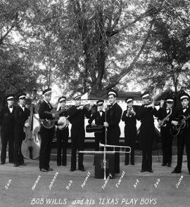
The Beryl Ford Collection online contains over 22,000 images. Depending on the person, there may be an image in this collection.
Unidentified People on Flickr
The Tulsa City-County Library would like your help indentifying the unknown people and places in our digital collections. Visit the library's special collections on Flickr and look for the unknown sets.