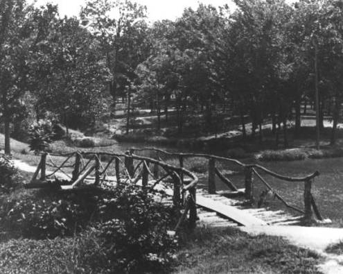
Woodward Park in the 1950s from the Beryl Ford Digital Collection
Have a question? Ask us!
Research Center
Tulsa City-County Library
400 Civic Center Tulsa, OK 74103
918-549-7323
rcaskus@tulsalibrary.org
National Parks
The National Park Service provides maps of most of their parks, memorials, national historic sites, and national historic trails. Simply choose a park and look through the information online, or check out one of the maps, brochures or booklets from the Government Documents collection in the Research Center.
The National Parks Conservation Association also has a national park locator allowing you to search by park name, state, category, or theme.
Find a list of links for maps of United States national parks and monuments in the Perry-Castañeda Library
Map Collection.
You can find more, varied information about our national parks from The National Parks Service
3-D views and photographic tours of park geology and natural history.
Explore the basics of geology as well as the unique geological elements found in some of our national parks.
National Forests
The US Forest Service prints visitor brochures and maps of their national forests and grasslands, plus specialty maps of their trails and national wilderness areas. These maps cover their attractions, facilities and services. We have many of these maps available for checkout in our Government Documents collection in the Research Center.
Tulsa Park & Trail Links
INCOG's link to Tulsa trails:
Bicycle/Pedestrian Trails
City of Tulsa Parks
List of parks and maps
Mary K Oxley Nature Center
Trail maps
Off-Leash Dog Parks
Biscuit Acres
Joe Station Dog Park
Tails and Ales
Riverside Park
A Gathering Place
River Parks Trail Map
Sand Springs' Keystone Ancient Forest
Trail map
Tulsa River Parks Authority's Turkey Mountain Urban Wilderness - Map
INCOG's Turkey Mountain Trail Map